


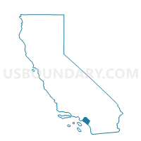
Voting District 30336, Orange County, California
About
Outline

Summary
| Unique Area Identifier | 535893 |
| Name | Voting District 30336 |
| County | Orange County |
| State | California |
| Area (square miles) | 10.31 |
| Land Area (square miles) | 10.31 |
| Water Area (square miles) | 0.00 |
| % of Land Area | 100.00 |
| % of Water Area | 0.00 |
| Latitude of the Internal Point | 33.73699920 |
| Longtitude of the Internal Point | -117.68990920 |
Maps


Graphs
Select a template below for downloading or customizing gragh for Voting District 30336, Orange County, California


Neighbors
Neighoring Voting District (by Name) Neighboring Voting District on the Map
- Voting District 30331, Orange County, CA
- Voting District 30332, Orange County, CA
- Voting District 30337, Orange County, CA
- Voting District 30338, Orange County, CA
- Voting District 30341, Orange County, CA
- Voting District 30342, Orange County, CA
- Voting District 30356, Orange County, CA
- Voting District 30361, Orange County, CA
- Voting District 30371, Orange County, CA
- Voting District 30401, Orange County, CA
- Voting District 32111, Orange County, CA
- Voting District 33111, Orange County, CA
- Voting District 33116, Orange County, CA
- Voting District 33128, Orange County, CA
- Voting District 33141, Orange County, CA
- Voting District 33161, Orange County, CA
- Voting District 33166, Orange County, CA
Top 10 Neighboring County Subdivision (by Population) Neighboring County Subdivision on the Map
- Anaheim-Santa Ana-Garden Grove CCD, Orange County, CA (1,648,519)
- Irvine-Lake Forest CCD, Orange County, CA (220,351)
- Silverado CCD, Orange County, CA (2,628)
Top 10 Neighboring Place (by Population) Neighboring Place on the Map
Top 10 Neighboring Unified School District (by Population) Neighboring Unified School District on the Map
- Orange Unified School District, CA (218,176)
- Saddleback Valley Unified School District, CA (205,432)
- Irvine Unified School District, CA (186,177)
Top 10 Neighboring State Legislative District Lower Chamber (by Population) Neighboring State Legislative District Lower Chamber on the Map
Top 10 Neighboring State Legislative District Upper Chamber (by Population) Neighboring State Legislative District Upper Chamber on the Map
Top 10 Neighboring 111th Congressional District (by Population) Neighboring 111th Congressional District on the Map
Top 10 Neighboring Census Tract (by Population) Neighboring Census Tract on the Map
- Census Tract 524.20, Orange County, CA (21,098)
- Census Tract 524.26, Orange County, CA (7,957)
- Census Tract 219.24, Orange County, CA (4,192)
- Census Tract 320.11, Orange County, CA (1,606)